Tire (Tire)
Advantaged by its fertile soil and suitable climate, Tire district's economy largely relies on production and processing of agricultural products, especially of figs, cotton, corn and other grains, cash crops like tobacco and sesame, fruits like watermelons, cherries, peaches and grenadines and dry fruits like walnuts and chestnuts.
Tire center has an attractive old quarter with many impressive examples of Islamic architecture, and lively Tuesday and Friday markets, where the influence of the multicultural population of the surrounding villages can be observed. These two markets on two days of the week are famous across the larger region and among visitors on excursion and tourists for the handcrafted items found on sale and they attract a large customer base. A yearly event that also draws crowds to Tire is one of the liveliest and the most rooted (since 1403) celebrations in western Turkey of Nevruz Day on the third Sunday of every March.
A famous local speciality is Tire kebab.
Tire center is an ancient town and it had already acquired considerable importance under the rule of the Lydians, called Tyrrha (occasionally spelled Tarrha) at the time and lying in the middle of the road connection between the capital of Lydia and the prominent portuary center of Ephesus.
While there are various suggestions regarding its form, many sources affirm the existence of a fundamental association between the city of Tyrrha and King Gyges of Lydia, who founded Lydia's Mermnad dynasty in the 7th century BC and laid the grounds for the Lydian expansion in the 150 years that followed. Some scholars indicate in all certainty that here was his birthplace, others claim that he first ruled here or the town was founded either by the 7th-century king or a previous namesake. Etymological similarity between the name of the city and such designations as Tyrrhenia, Tyrrhenians and tyrant have also been pointed at or disputed.
The etymology of the name Tyrrha itself was suggested as being an indigenous Lydian language word and explained in terms relative to the English language word "tower".
Tire developed strong ties with the Ottoman capital and administration, both economically and in terms of its population make-up, especially after the 15th century, since Tire became a retreat where palace personnel, including members of the harem, were sent for their retirement days. Timur (Tamerlane) spent the winter of 1402/1403 based in Tire, after his defeat of the Ottoman forces at the Battle of Ankara, a span of time he used to capture Smyrna lower castle from the Knights of Rhodes, to acquire the city of İzmir fully for the Turks, and his stay here is also at the origin of Tire's noted Nevruz celebrations referred to above.
Map - Tire (Tire)
Map
Country - Turkey
 |
|
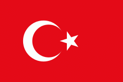
| Flag of Turkey | |
One of the world's earliest permanently settled regions, present-day Turkey was home to important Neolithic sites like Göbekli Tepe, and was inhabited by ancient civilisations including the Hattians, Hittites, Anatolian peoples, Mycenaean Greeks, Persians and others. Following the conquests of Alexander the Great which started the Hellenistic period, most of the ancient regions in modern Turkey were culturally Hellenised, which continued during the Byzantine era. The Seljuk Turks began migrating in the 11th century, and the Sultanate of Rum ruled Anatolia until the Mongol invasion in 1243, when it disintegrated into small Turkish principalities. Beginning in the late 13th century, the Ottomans united the principalities and conquered the Balkans, and the Turkification of Anatolia increased during the Ottoman period. After Mehmed II conquered Constantinople (Istanbul) in 1453, Ottoman expansion continued under Selim I. During the reign of Suleiman the Magnificent, the Ottoman Empire became a global power. From the late 18th century onwards, the empire's power declined with a gradual loss of territories. Mahmud II started a period of modernisation in the early 19th century. The Young Turk Revolution of 1908 restricted the authority of the Sultan and restored the Ottoman Parliament after a 30-year suspension, ushering the empire into a multi-party period. The 1913 coup d'état put the country under the control of the Three Pashas, who facilitated the Empire's entry into World War I as part of the Central Powers in 1914. During the war, the Ottoman government committed genocides against its Armenian, Greek and Assyrian subjects. After its defeat in the war, the Ottoman Empire was partitioned.
Currency / Language
| ISO | Currency | Symbol | Significant figures |
|---|---|---|---|
| TRY | Turkish lira | ₺ | 2 |
| ISO | Language |
|---|---|
| AV | Avar language |
| AZ | Azerbaijani language |
| KU | Kurdish language |
| TR | Turkish language |


